Results 111 to 120 of 123
Thread: Cebu City Weather Update
-
02-07-2009, 04:41 PM #111
-
02-13-2009, 08:45 AM #112
-
02-13-2009, 08:47 AM #113
At 2:00 a.m. today, Tropical Depression "BISING " was estimated based on satellite and surface data at 60 kms East Southeast of Surigao City (09.6°N 126.2°E). Tail-end of a cold front affecting Visayas.
Forecast
Eastern and Central Visayas and Northern Mindanao will experience rains and gusty winds and the coastal waters along these areas will be moderate to rough. The rest of Visayas and Mindanao will have cloudy skies with scattered rainshowers and isolated thunderstorms. Luzon will be partly cloudy to at times cloudy with isolated light rains.
Moderate to strong winds blowing from the Northeast and East will prevail over Eastern Luzon and its coastal waters will be moderate to rough. Elsewhere, winds will be light to moderate blowing from the Northeast and Northwest with slight to moderate seas.
-
02-13-2009, 08:47 AM #114
OMG...
ngit ngit langit...
-
02-13-2009, 08:51 AM #115
CEBU
Light Rain
Feels Like:
86° F
Barometer:
29.77 in and steady
Humidity:
79%
Visibility:
6.21 mi
Dewpoint:
73°
Wind:
NNW 5 mph
Sunrise:
6:05 am
Sunset:
5:52 pm
-
02-13-2009, 09:02 AM #116
signal no. 1 ang cebu...paet, mafiring squad man cguro ko diri sa leyte if d kauli
-
02-13-2009, 09:07 AM #117
-
02-13-2009, 10:14 AM #118
-
02-13-2009, 11:07 AM #119

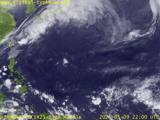
Tropical Depression BISING quasi-stationary off the island of Siargao.
*Residents and visitors along Northern Mindanao and Visayas should closely monitor the progress of BISING.
*Kindly refer to your local warnings & bulletins issued by your country's official weather agency. This advisory is intended for additional information purposes only.
+ Forecast Outlook: BISING is expected to track westerly for the next 2 days, crossing Surigao del Norte today. It shall pass over Bohol-Southern Cebu-Negros Island area tomorrow before moving into Sulu Sea on Sunday, Feb 15. BISING might dissipate upon crossing the Visayas due to multiple island terrain interaction.
+ Effects: BISING's broad circulation is expected to bring scattered widespread rains with weak squalls and thunderstorms across portions of the Visayas, Bicol Region, Southern Luzon and Mindanao today. Residents in low-lying areas & steep slopes must remain alert & seek evacuation for possible life-threatening flash floods, mudslides & landslides due to the anticipated heavy rains brought about by this system. Precautionary measures must be initiated if necessary.
[Important Note: Please keep in mind that the above forecast outlook, effects, current monsoon intensity, & tropical cyclone watch changes every 6 to 12 hrs!]
Time/Date: 6:00 AM PST Fri Feb 13 2009
Location of Center: 9.7º N Lat 126.0º E Lon
Distance 1: 55 km (30 nm) East of Surigao City
Distance 2: 210 km (113 nm) SSE of Tacloban City
Distance 3: 240 km (130 nm) East of Tagbiliran City
Distance 4: 240 km (130 nm) ESE of Cebu City
Distance 5: 355 km (192 nm) SE of Bacolod City
MaxWinds (10-min avg): 45 kph (25 kts) near the center
Peak Wind Gusts: 60 kph (33 kts)
Saffir-Simpson Scale: Tropical Depression
Coastal Storm Surge Height: 0 feet [0 m]
Central Pressure: 1006 millibars (hPa)
Recent Movement: West @ 04 kph (02 kts)
General Direction: Surigao-Leyte Area
Size (in Diameter): --- km (--- nm) / Small
Max Sea Wave Height (near center): 8 ft (2.4 m)
PAGASA TrackMap (for Public): 2 AM PST Fri Feb 13
Zoomed Satellite Pic: Near Real-Time
PHILIPPINE STORM WARNING SIGNAL # ONE (1)
In Effect: EASTERN & WESTERN SAMAR, BILIRAN, LEYTE PROVINCES, CEBU, BOHOL, NEGROS ORIENTAL, SIQUIJOR ISLAND, DINAGAT PROVINCE, SIARGAO ISLAND, SURIGAO DEL NORTE, SURIGAO DEL SUR, AGUSAN DEL NORTE, CAMIGUIN, & MISAMIS ORIENTAL.
source: typhoon2000.com
-
02-26-2009, 08:05 AM #120Junior Member

- Join Date
- Feb 2009
- Gender

- Posts
- 74
init na sad..
Advertisement
Similar Threads |
|


 Reply With Quote
 faet... uwan nasad...

